Sunday 12 December 2021

Winter starts: Brauneck (1555 m) ski tour

Right from the beginning of December 2021, it snowed a couple of times and so people were ski touring. Today, the 12.12. was the official opening of the Brauneck winter season. The Brauneck is just a wee bit more than 60 km and 40 min from my front door so this is our local hill. Arno and I left a grey Munich to arrive at a sunny Draxlhang car park where many cars were stuck in the snow. 

Here, Arno sets off from the car park (with 50% of the other Münchnerinnen and Münchner it seemed).

The Brauneck ski tour goes into the forest...

... and then climbs 840 altimetres mostly through forest. Today it was a dream with snowed-up trees and sunshine. It seemed much more like spring than December. 
Here another gorgeus photo of Arno in a winter wonterland. 
Just below the summit we hit open ground near the piste. 
We quickly ascended to the busy summit of the Brauneck...
... to view the Glen and Bad Tölz below...
... before descending to a ski hut below the summit for a bite to eat, sun bathing, de-skinning (the ski's), and getting ready for the on-piste descent. 
Here a view South to nearby Austria and some distant peaks will be in Italy. 
Here, we start skiing. Fantastic, easy skiing conditions with a gorgeous backdrop.
Here, a wee bit lower with a view to the East. 
A few slopes and we arrived at the busy Draxlhang with the busy car park below. 
A great, unexpectedly sunny start to the season. Also, being so close, it does not take all day. Arno picked me up at 8.30 h and I was home just after 13 h. 
HW

Monday 29 November 2021

Winter epic: From Kochel via the Benediktenwand (1800 m) to Lenggries

Public transport is excellent in Munich (apart from the odd "signal problem"), climate change is real and Alpine peaks are close. So putting one and one and one together, this means that we should mainly use public transport for mountaineering.

So on 28.11.2021 just at 7.17 h, I took the S3 S-Bahn to Munich main station and at 7:59 h I was sitting on the regional train to Weilheim. A quick change at Tutzing to Kochel, a bonny town on lake Starnberg. The tracks were dusted with snow and so although it was just the end of November, it was clear that this would be a snowy day. What was not quite as clear was that this would be a hard, epic mountain day with a nocturnal finish.


Kochel to Benediktenwand (1800 m). Here is the regional train in Kochel, the end of the line and the start of the walk. Plenty of snow already at the lowest point!

I had planned the tour via Komoot and had map & compass, a Garmin watch with mapping function and Komoot (https://www.komoot.de/tour/583493929) on the phone for navigation. After the station in Kochel the walk entered quickly the maze of paths in the forest and I went wrong a few times due to my lazy navigation. At times there were some blue skies with and at times I could see the bright white plains through the trees. Here is one of those views...

... and here is another one...

I then ascended snowy paths to the Olperer Alm which is here...

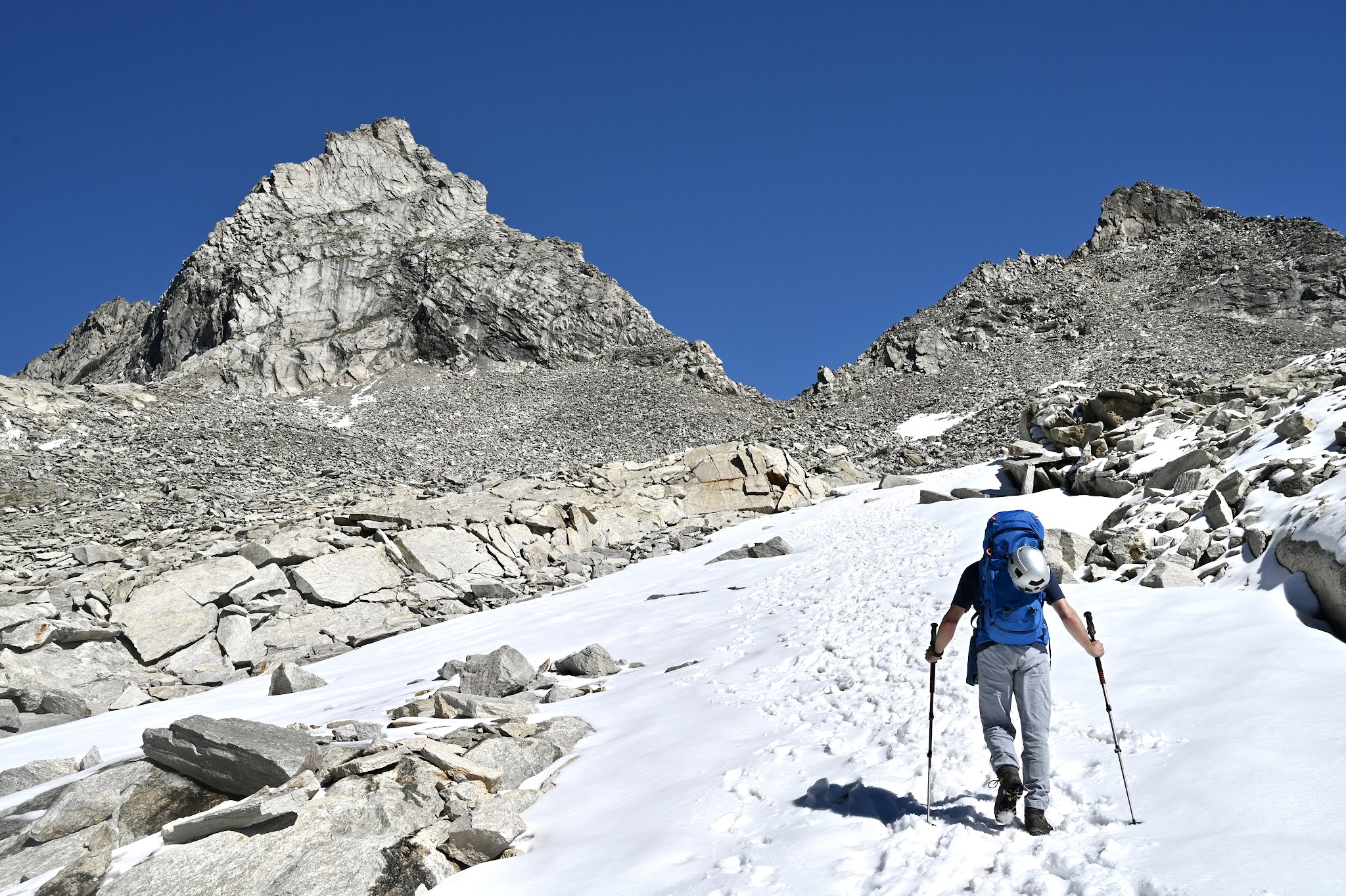
After the Olperer Alm, I ascended the Rosengarten, a steep zig-zag ramp that is hard to see under snow. Then easy paths under 20 cm of snow on the Southern side of the Glaswand before the last climb up to the Benediktenwand (1800 m). Here is a sign showing the way... 

I met a team of three who had a (very) cold night in the Brauneck Schutzhütte. They were roped up with an olive rope and also carried military gear so I assume they were army folk...

In the Benediktenwand Schutzhütte I cooked some Korean noodles and had a 10 min snooze. Also, I realized that I had not done half of the walk. I left the hut at around 13.30 h, I think.


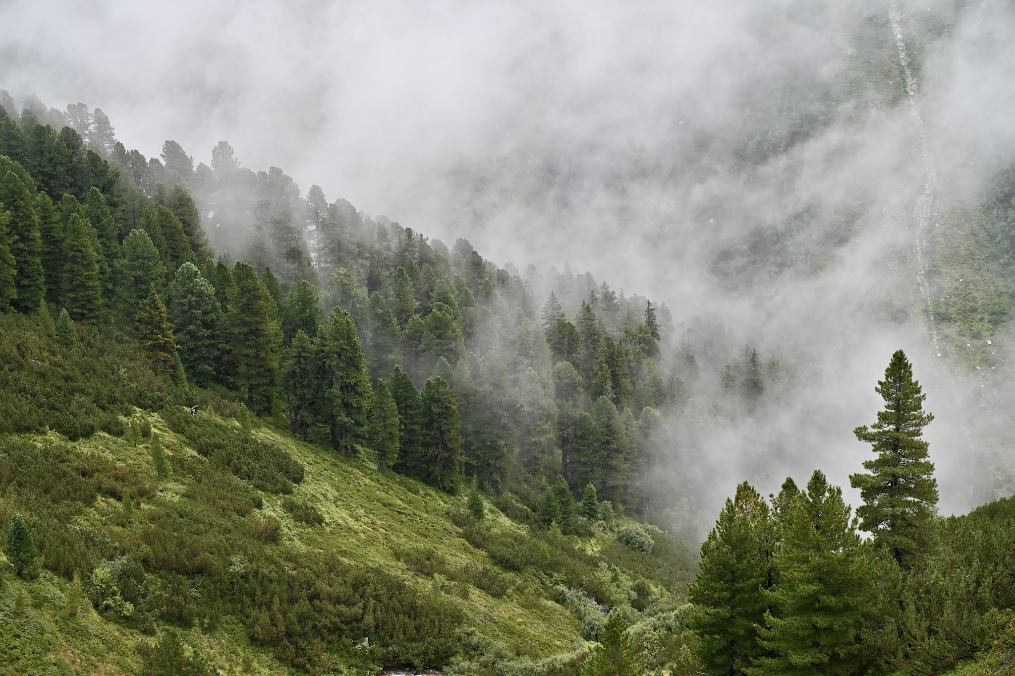
Benediktenwand to Lenggries. This part was tougher than anticipated not helped by the fact that I missed the presumably easier lower path and instead followed a Cuillin-like route which was hard to find amount the Latschen (small pines). I went the wrong way a few times and ended up in the thicket and had to reverse. The scrambling was easy enough and there were icy steel cables at times. The route went over various exposed „Köpfe“ such as the Achselköpfe (watch out for animal protection zone signs). Here is a brief moment when the fog lifted...

I eventually found a trail to the „Idealhang“ of the skiing area and I really should have descended here. Instead, I went past this wooden chapel...

... and snowed up myself (it was getting dark at this point)...

... to the hut near the top of the Brauneck as I knew this bit from countless ski tours. Here, one photo of the glen below where the regional train was waiting for me.

So I was walking, jogging, and bum-sliding down the piste to the Wegscheidalm. Another 3-4 km to Lenggries train station which was waiting for me after probably 24 km (my watch battery only lasted to the Brauneck) of walking and nearly 2000 altimetres.


In summary, this is an eco-friendly mountaineering traverse of the Benediktenwand, a classic, Bavarian mountain. It is tough in summer and I found it epic in winter. The key difficulties in winter are route finding, the distance, and nearly 2000 m of ascending (Strava said 1800 m before the battery went flat so I assume 2000 m).

HW

Sunday 26 September 2021

Zsigmondyspitze (3089 m) with Arno on a dream early autumn day

Friday the 24.9.2021 was the Friday before the last weekend of my holidays. I really like the Zillertal as it can be reached in less than 2 h from Munich and reminds me of Scotland. The forecast predicted a last summer-like weekend with temperatures well over 20 degrees. Because of that, Arno and I met at 7 am at my place. At 9 am, we started walking from the car park of the Breitlahner guest house and walked towards the Berliner Hütte in the early morning sun.

Here is Arno with two stunning waterfalls which must be great ice climbs in winter. 

Here, Arno is leaving the gorge...

... and here is the Berliner Haus, a mountain "hut" (more a hotel) which retains the Gründerzeit charm of the 1880s.

The dining room is like over 100 years ago but we had a coffee and Apfelstrudel outside with glacial views. 

We then went Northwards and the Zsigmondyspitze, the Matterhorn of the Zillertal appeared. It is a 250 m high Gneiss pyramid. 

Here the view to the Southeast with a sad-looking glacier that will disappear in the next 10-20 years,

Here a view to the South. The highest point of that Italy-Austria border ridge is the Hochfeiler (3510 m) which I had climbed in summer with Marco and Heidi the dog. 

We reached a band of snow and ascended that under a deep blue sky to reach the bealach to the East of the Zsigmondyspitze. 

Here, we are nearly there. What a mountain!

Out of breath from the altitude, we took our time to gear up and start climbing. The rock is excellent Gneiss and it 

After two or three pitches, the easiest line is a walk and then easy friction slabs with some bolts to the left. Here is Arno in a sea of slabs. It is easier than it looks so not like the Etive slabs!

After that a rising walking and scrambling traverse back to the South ridge...

... followed by two more pitches up the ridge and an easy scramble on the right of the edge to the top. 

There are three abseil points and the rest is easy down climbing. Here is Arno preparing one of the abseils...

... here we meet the only other team on the hill...

... and here an exposed abseil back to the base. 

Some days cannot be better. But it was a long day with 1800 m of ascending and descending plus 28 km of walking plus some hours of climbing. 

HW


Zillertal Hoher Riffler (3231 m) in the snow

On the 28th and 29th of August Ana was busy. This meant that I had a weekend for myself but unfortunately the weather forecast was rain, rain & rain. So I checked my mountain books for a 3000 m peak because above 2000 m rain would be snow and snow is much nicer than rain. I decided to attempt the Hoher Riffler in the Zillertal, described as a walking mountain. 

The walk starts at the Schlegeisspeichere, a reservoir surrounded by 3000ers at the end of the Zillertal. There is a 14 EUR Mautstraße up to it, parking included. The first part of the walk goes to the Friesenberghaus. 

Lovely pine forrests and the grass and vegetation on this misty day reminded me of bonny Scotland. 

This is just around 2000 m.

Here some of the ubiquitous cows... 

... and here a view to the other side of the glen with a first dusting of snow. 

At around 2400 m of altitude, things turned white and again it all reminded me of Scotland. 

I reached the large Friesenberghaus...

... which was built in 1928 by the Berlin section of the German Alpine Club. 

I went past and brewed some Korean noodles under an overhanging boulder. 

The ascent to the Hoher Riffler was a long, long, blocky ridge under 20 cm of snow with little visibility. 

After several hours of scrambling I reached the summit of the hoher Riffler. 

After a long slippery descent I regained the snowline and as temperatures had risen, the snow melted and a lot water cascaded into the glen. 

Again, the misty, green glen reminded me of Scotland. 

An awful weather weekend but a great, challenging 3000 m peak that from time to time sent me down the Scottish memory lane.

HW