Friday 4 June 2021

Bayerischer Wald

Normally, the direction for the Münchner's is South, to the Austrian and Italian Alps, and to the Lago di Garda and beyond. But to the East is the Bayerischer Wald, literally translated as Bavarian Forest. It is a region of gentle hills up to near 1500 m with a National Park which is an unmanaged forest. There is also the border to the Czech Republic and the Bohemian forest within the Bavarian forest. For a change, Ana and I decided to visit the Bavarian forest for some gentle walks. Here is Ana during day 1 where we aimed for the Grosser Arber (1456 m), the highest peak of the Bavarian forest.

The top of the Grosser Arber is a bit of a let down as it is a Nato radar station presumably because it was close to the Iron curtain pre-1989. 

On the way down we followed a stream that turned into a waterfall. I carried a tripod and it was well worth it, as I took a tack sharp photo showing the rusty red and green plus the soft lines of the falling water during an exposure that was longer than 1 s.
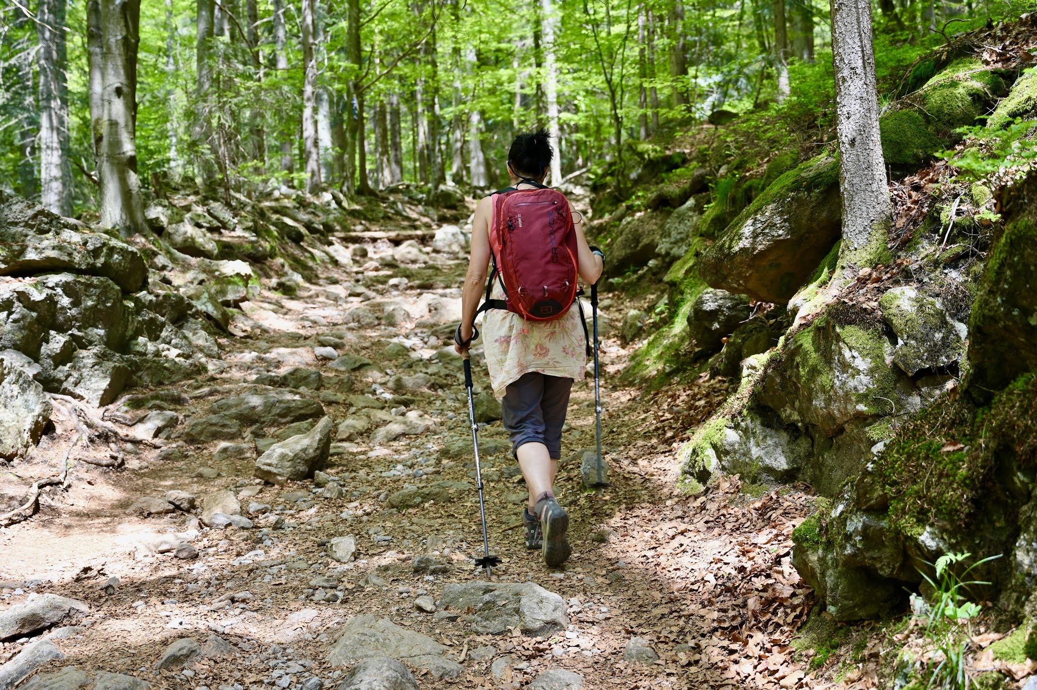
On day 2 we aimed for the Grosser Rachel (1453 m), a mere 3 m short of the Grosser Arber. Here is Ana during the ascent reaching the point where the thick forest opened up.
High up many trees were dead presumably because of storms and because of the infamous Borkenkäfer, a bug who kills trees.
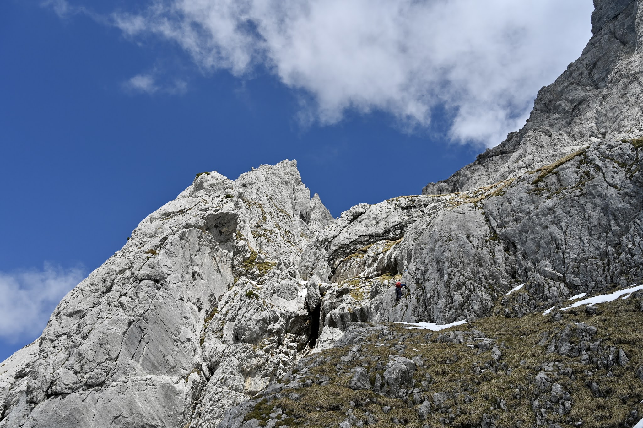
Below the summit of the Grosser Rachel is a hut but unfortunately, it was shut. The grosser Rachel is the hill behind.
Here is the summit with views into the nearby Czech Republic.
Here is Ana at the summit cross of the Grosser Arber...
... and here she descents.
On the way down there is a chapel and a lake with views over the National park forest.
On the third day, rain was forecast but in the end, it stayed dry. We did a low-level walk near Viechtach, a wee town which we visited for a triathlon training camp in our tweens. Lots of stories...

Overall, the Bavarian forest is a great area for straightforward hill and forest walking. Accommodation, food, and beer are cheap and there are some multi-day walks. Ana and I cannot wait to visit it in winter as Nordic skiing is supposed to be excellent. 
HW


Kraxengrat (IV-) Alpine style, Wilder Kaiser

Norbert Wortberg is a study friend of mine who lives in the Eifel, a hilly region near Cologne. And Nobbi needed adventure. So we decided to meet at the Jägerwirt above Scheffau at the Wilder Kaiser for the Kraxengrat, an 18-pitch IV- Alpine ridge which I had previously climbed with Simon albeit with hardly any snow. This time, there was still a lot of snow after lots of snow fall in late winter and so we took crampons and ice axes. Here, Nobbi crosses the first wet snow avalanche field.

We carried three ice axes but after the approach, the ridge was mostly snow-free. When we were on pitch two, a fast, guided pair appeared at the bottom of the ridge who overtook us. Here is a photo of them overtaking us.

After the first three pitches, we reached a walking pitch with the ridge proper seen on the left.
The climbing was mainly 2-3. Just lots of straightforward climbing with the odd bolt. Here is Nobbi tackling one of the steeper bits.
Here, views of the Treffauer to the South, one of the major Kaiser peaks.
The ridge has two cruxes. The first is an exposed diedre which is easier than it looks. The second crux is a steepish wall graded IV-, probably severe in UK money, climbed in big boots. Here is Nobbie at the end of the second crux.
The ridge is 18 pitches long. There are some bolts but bringing slings and some extra gear helps. Here is Nobbi on an exposed downclimb that is the last tricky-ish bit. 
Here Nobbi again clinging on to some rock.
We finally topped out but a wee bit late. Luckily it was cloudy and so whilst the snow was wet it was not totally falling apart. First, a ridge walk with gorgeous views towards Kufstein and the Inn valley.
And then a descent down some wet, heavy slopes. Luckily the snow was not too deep and there were clouds so that it remained largely stable. 
And finally green pastures and some deep blue Gentian, my favourite Alpine flower.
The Kraxengrat is such a great mountaineering route and one of the few easy routes on the Wilder Kaiser. Definitely recommended.
HW

Rabenkopf (1555 m)

Monday, the 24.5.2021 was Whitsun Monday (Pfingstmontag), a public holiday in Bavaria. The weather forecast was poor and so I decided to do a wee mountain run from Jachenau, a village in the Bavarian Alps roughly 60 km from home. Lots of Alpine flowers. The most impressive is the Alpine Gentian. It stands out due to its deep blue colour.

Here some signs showing the way to the Rabenkopf (1555 m) one hill of many.
Here the summit cross. My preference is to leave no trace and to leave the hills as they are but in this area, each hill has a cross on top. In the distance is the "Alpenhauptkamm" still with tons of snow. 
A sign on the way down showing the way back to Jachenau.
In the forest, I was using a Lee big stopper filter for the first time. This filter extends exposure times and so the water turns into soft lines. I was pleased with the result. 
Even if the hill or walk is not special, the hills and mountains never really disappoint even if it is rainy and gray. 
HW