How did we get the idea to cycle through Puglia? Friends of ours, an US-Italian couple, spend many of their summer holidays in Puglia, the heel of the Italian boot. So when they spoke about it, Ana and I became intrigued and we decided to spend our 2019 summer holidays cycle touring Puglia. At the end of September, we had warm summer weather (22-30 degrees), saw white towns on hills and Trulli plus relaxed on sandy beaches. In this blog, we describe our trip plus give some tips on how to cycle tour Puglia.
One day before: Major change of plan.
We had booked a 21 h Flixbus trip from Munich to Bari as Flixbus would take our bikes. But the day before departure, Flixbus sent the following message.
We had booked a 21 h Flixbus trip from Munich to Bari as Flixbus would take our bikes. But the day before departure, Flixbus sent the following message.

No bikes on the Flixbus to Rome because of a technical defect. F*** No bus to Rome = no bus to Bari. What to do? Driving the car and parking it in some Mafia village (cliche warning!) for 2 weeks? I booked Bari airport car park and we drove the 1200 km by car, stopping once on the way.
Day 1: Bari airport to Matera (77 km)
Here is Ana at the starting line. It is Bari airport car park. On the way to Bari it rained almost the whole way with some heavy thunderstorms. Nonetheless, more half the time than the Flixbus.

Out of the airport into an industrial area. I had downloaded a map from Komoot but it led us onto everything from bumpy mountain bike tracks to almost Autobahns, so did not work as beautifully as it does in Munich. It took us ages to cross the motorway and we went via Bitonto instead of via Modugno. Here is Ana just out of Bari...

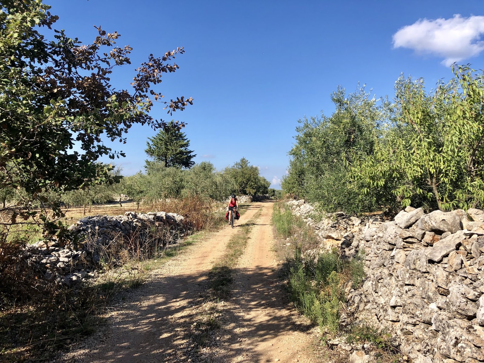
... and here we are on a gravel track through olive tree plantations that cover much of Puglia.
We then crossed from the Bari region to Matera...

... which we reached in the last light of the day. Matera is an old town on a hill with Sassi, which are caves and homes inside the hill.

Ana in our cave accommodation with our bikes.

A beautiful city on a hill made out of white-to-beige limestone and sandstone. The next morning we were viewing the city...

... its cathedral...

... before saddling our horses and riding off. Don Quixote and Dulcinea exploring the Italian South.

Day 2: Matera-Alberobello (68 km)
Komoot sent us onto a long gravel road to Gioia del Colle. However, we decided to stay on the road and so we took the "yellow road" to Santeramo in Colle. It was warm to hot, not far off 30 degrees and there was little shade. Good that we did not go in mid-summer when temperatures might approach 40 degrees.

Here is my bike. It is a Trek 520 which comes with front and rear racks but without mudguards. Highly recommended for heavy touring even though the components are relatively cheap.

Soon we saw the first Trulli (singular Trullo) which are small houses built without mortar. Fun for Smurfs but probably too dark and small for their inhabitants.

It was overcast and a bit cooler which was particularly welcome during the ascent to Gioia del Colle...

..., a town on the hill with views over the Hinterland.

We then spend the evening in Alberobello which is the Trulli-Epicentre and touristic.
Day 3: Alberobello to Ostuni (26 km)
Our easy day. As we had to cover little distance, we decided to explore smaller roads and gravel tracks to Ostuni. Here is Ana on a gravel track in yet another Olive plantation...

... and here Ana is on a hill with the first view of the Adria since our departure.

We soon arrived in Ostuni, which is a white town on a hill best viewed from the East. We struggled to find our accommodation in the maze of small alleys but eventually found our B&B with a gorgeous garden. Here is Ana in one of the narrow alleys...

... and here in another one.

We had plenty of time to visit the cathedral...

... and enjoy a blue, red and purple evening sky.

Here another photo.

Day 4 Ostuni to Gallipoli (102 km)
Our next accommodation e-mailed us that it had a flooding so we decided to cycle all the way to Gallipoli and then to stay to days in Gallipoli. Before that breakfast. How do Italians manage to stay so lean on average? High fat, high protein? Here is the breakfast in Ostuni. Hardly any fat or protein but sugar, sugar and even more sugar. The Italian trick seems to be to just eat a small, sweet piece together with at least 1 Expresso.

Luckily a tailwind was pushing us and it was flat and so we were gliding on big roads from Ostuni via Sani-Vito die Normanni, Mesagne and then on smaller roads towards the coast which we reached near Torre Cesareo.

Beautiful views of the Ionian sea.

At times the road went more inland and it was again close to 30 degrees.

Here is my cockpit: Garmin GPS, map & Suunto GPS watch.

We had to climb one hill...

... from the sea...

... up into a pine wood...

... to then find a beach in Santa Maria a Bagno just before Gallipoli.

We swam and we turned our bikes into laundry racks.

Here, Ana is cycling the last kilometres into Gallipoli.

We had booked accommodation in the old town of Gallipoli, which is built on a rocky island that is connected to the mainland via a short causeway.
Day 5 Gallipoli (almost rest day, 14 km)
We cycled via the causeway ...

... to Baia Verde, a long beach South of Gallipoli...

... for relaxation.

Beautiful! But as so often in Italy beauty and ugliness are close together. Rubbish by the roadside on the way back. The locals seem to chuck glass and plastic out of their cars and so there is tons of glass and plastic near the roadside. Greta Thunberg or David Attenborough, a job for you!

Here fishermen in the harbour of Gallipoli...

... and here old town beach in warm evening light.

We had seafood and white wine as an aperitif on the Northern side of the causeway (just look down). Great for non-vegans.

Day 6 Gallipoli to Leuca (56 km)
From now on every day was a ride by the coast and doing inland places first before cruising the coast works well. On our way out we passed the old town beach in the morning light once more...

... passed fishermen in the harbour...

... before following the coastline.

After Baia Verde the coast is more rocky with few opportunities for a swim...

... but in Marina di Pescoluse we found another beach for the afternoon.

Here a high chair for the life guard.

We carried on...

... and arrived in Leuca where the Ionian See meets the Adriatic. We stayed in a hotel overlooking the sea.

Day 7 Leuca to Otranto (54 km)
After Leuca the cliffs grew in size and so we climbed out of Leuca...

... to visit the Santa Maria di Leuca lighthouse, one of the most famous in Italy.

After that more climbing to 150 m above sea level...

... followed by a long descent with a view over the Adria.

This ride high above the Adria was...

... eye candy.

However, there were only few sandy beaches on this stretch of the coast. Here is one that is particularly gorgeous...

... with a wee bit of sand.

Here my Trek 520 and Ana`s Cube gravel bike.

Adriatic flowers on the way...

... here Ana...

... and here more views.

We passed the town of Castro with a view back towards Leuca...

... and then descended into...

... Santa Cesara Terme, a spa with sulfur springs...

... to reach Otranto. Otranto also has an old town with a cathedral, high walls and views over the Adria.
Day 8 Otranto to Lecce (51 km)
Ana had booked an apartment just outside Otranto with several cats...

... and more olive trees.

Otranto also has a beautiful beach.

We followed roads near the sea...

... passed a beach just after Torre Santo Stefano...

... but carried on...

... with the odd cycle sign...

... to Torre dell'Orso. A gorgeous beach with pines to park our bikes and shade to get out of the sun.

Several swims in the clear and warm Adria...

... before heading inland to Lecce, the Florence of the North. Here are Don Quixote and Dulcinea with some windmills behind.

I have only evening photos of Lecce but it is a town to explore for a day.
Day 9 (Lecce to Lecce train station, Bari to Bari airport and then home)
We rose early and passed Lecce cathedral again on our way to the train station.

We were a bit nervous about transporting our bikes by train back to Bari but full points to the regional trains of Treniatlia for friendlyness and bike transport. The young train advisor helped us a lot and the regional train from Lecce to bari has half a carriage for bikes.

We had plenty of time to secure our bikes as Lecce was the start of the train ride.

We got to Bari on time and I cycled to the airport car park.
Overall a fantastic trip in Italian sunshine whilst autumn had arrived in Munich. However, take rain clothes as we had heavy showers on the car journey to Puglia and on the way back to Munich.
Practical trips: Puglia is hot so do your trip either before midsummer or after August. Puglia is popular now but during these times the masses will have disappeared. The trip is a great combination of culture, nature and seaside and the rubbish by the roadside detracts only a little. There are now several companies that rent bikes (we leave the googling to you) but we preferred our own bikes. Ensure to have puncture-resistant tyres because of all the glass. Whilst train travel <300 km is easy and works great in Italy, it does not seem to be possible to travel from Munich to Bari by train without changing many times. We cannot say whether the Flixbus issue is a one-off but perhaps have a backup option ready if you book Flixbus. For us, driving from Munich to Bari plus safe parking in an airport car park worked well but has a larger carbon footprint. About the Mafia cliche. We, of course, do not know what really goes on but we felt safe all the way. However, we ensured that we could take our bikes into the places we stayed and in addition, I took a heavy Kryptonite lock. The accommodations we booked were all tidy, some were gorgeous and the owners were generally helpful.
HW


